


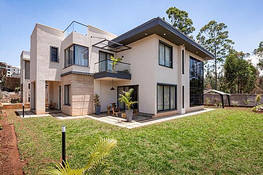
Transport is the conversation Kilimani residents have more than any other. Not the restaurants, not the apartments, not the schools. The traffic. Ask someone who has lived in Kilimani for two years what they would change about the neighbourhood and the answer is almost always the same: they would fix the roads, reduce the congestion, or move their office closer to home to avoid the commute altogether.
This is not an exaggeration and it is not unique to particularly unfortunate residents. It is the structural reality of living in one of Nairobi’s densest residential neighbourhoods, at the intersection of three major arterial roads, during a period when the city’s vehicle population has grown significantly faster than its road infrastructure. Understanding the transport situation in Kilimani before you commit to an address there is not optional. It is essential.
What this guide provides is an honest, street-level account of how transport actually works in Kilimani in 2026. Not the optimistic picture of off-peak travel times that agents sometimes present during property viewings. The real picture, including the worst-case scenarios that residents encounter regularly, and the practical strategies that make daily movement manageable for people who have figured out how to navigate the neighbourhood effectively.
This article is part of the Kilimani Neighbourhood Guide. For the full neighbourhood context, start with the Complete Guide to Living in Kilimani Nairobi.
The Road Network Around Kilimani
Kilimani is bounded and penetrated by three significant road corridors, and understanding how each of them behaves is the foundation of understanding transport in the neighbourhood.
Ngong Road
Ngong Road is the southern boundary of Kilimani and the primary arterial road connecting the neighbourhood to the CBD in one direction and to Karen, Langata, and Ngong town in the other. It carries the highest vehicle volumes of any road touching the neighbourhood and is the most consequential road for Kilimani residents’ daily commute experience.
The Ngong Road dual carriageway upgrade improved flow somewhat from the worst years of the mid-2010s, but it did not solve the fundamental problem of a road that carries more vehicles than it was designed to handle. The bottlenecks are structural and predictable. The junction at Haile Selassie Avenue where Ngong Road feeds into the CBD approach is one of the worst in the city during morning peak hours. The junction at Mbagathi Way near Junction Mall creates queuing that backs up past Prestige Plaza on the Kilimani side. The junction at Valley Road adds to the stacking during the afternoon return.
Morning peak on Ngong Road inbound runs from approximately 6:45 AM to 9:30 AM. The worst period is 7:15 AM to 8:45 AM. During this window, the journey from the Kilimani end of Ngong Road near Adams Arcade to the Times Tower area in the CBD can take between 40 and 70 minutes by car. The same journey at 6:15 AM takes under 15 minutes. At 10:00 AM it takes 20 to 25 minutes. The gap between these figures is the single most important piece of transport data for any Kilimani resident who commutes by car.
Evening peak on Ngong Road outbound runs from 4:15 PM to 7:30 PM. The worst period is typically 5:00 PM to 6:45 PM. Residents returning from Upper Hill or the CBD during this window regularly sit in queues that extend well past the Prestige Plaza junction and into the suburban sections of Ngong Road. The difference between leaving the office at 4:00 PM versus 5:30 PM on a Friday evening can be 40 minutes or more on this route.
Argwings Kodhek Road
Argwings Kodhek Road runs through the eastern edge of Kilimani, connecting Hurlingham in the south to Milimani Road and the approach to Upper Hill and the city centre in the north. It is the primary route for Kilimani residents commuting to Upper Hill, Hospital Road, and the broader south-central business zone of Nairobi.
Traffic on Argwings Kodhek Road during morning peak is heavy but generally more manageable than Ngong Road. The principal bottleneck is the Hurlingham roundabout where Argwings Kodhek meets Ralph Bunche Road and the approach roads from Kilimani’s internal streets. This roundabout becomes severely congested between 7:30 AM and 9:00 AM, with vehicles queuing back from the roundabout along multiple approach roads simultaneously.
The Upper Hill section of Argwings Kodhek Road above the Nairobi Hospital junction carries significant volumes from hospital staff, office workers, and through-traffic heading toward Valley Road. The stretch between Nairobi Hospital and the Valley Road junction is slow from 7:45 AM onwards during the week. Residents who use this route to access Upper Hill offices have found that leaving before 7:00 AM or after 9:30 AM produces meaningfully better journey times than the peak window.
Valley Road and Denis Pritt Road
Valley Road forms the northern boundary of Kilimani and provides one of the more direct connections between the western residential suburbs, Kilimani itself, and the city centre via University Way. Denis Pritt Road, running roughly parallel to Argwings Kodhek Road through the interior of Kilimani, is used heavily as a cut-through by residents trying to avoid the main arterial queues.
The problem with using Denis Pritt Road as a cut-through is that every other Kilimani resident with the same idea is doing the same thing simultaneously. During peak hours, Denis Pritt Road between its Lenana Road junction and the Valley Road approach becomes as congested as the main roads it was chosen to avoid. The internal Kilimani road network has not been designed for the volume of cut-through traffic it now carries, and the construction vehicle movements associated with the neighbourhood’s ongoing development activity add additional unpredictable blockages.
Lenana Road, which runs through the commercial heart of Kilimani connecting Ngong Road to Denis Pritt Road and beyond, combines residential through-traffic with delivery vehicles, school run traffic, and commercial activity at street level. During peak school hours between 6:30 AM and 7:45 AM, Lenana Road can be nearly stationary between its Ngong Road junction and the mid-section near the Java House cluster.
Commute Times From Kilimani: Realistic Figures
The following commute times are based on current conditions in 2026. They represent typical journey times during peak and off-peak periods rather than best-case or worst-case outliers.
- Kilimani to CBD (Times Tower / Kencom area): 15 to 20 minutes off-peak. 40 to 70 minutes during morning peak via Ngong Road. Via Argwings Kodhek and Valley Road, 30 to 55 minutes during morning peak.
- Kilimani to Upper Hill: 8 to 12 minutes off-peak via Argwings Kodhek Road. 25 to 40 minutes during morning peak.
- Kilimani to Westlands: 15 to 20 minutes off-peak via Valley Road and Waiyaki Way. 35 to 55 minutes during peak hours depending on conditions at Museum Hill roundabout.
- Kilimani to Karen: 20 to 30 minutes off-peak via Ngong Road. 50 to 75 minutes during evening peak on Ngong Road southbound.
- Kilimani to Gigiri or Runda: 20 to 30 minutes off-peak via Valley Road and Muthaiga. 45 to 70 minutes during peak depending on conditions at the Westlands interchange.
- Kilimani to JKIA: 25 to 35 minutes off-peak via Ngong Road and the Southern Bypass. 60 to 90 minutes during peak hours. Early morning flights are genuinely stressful from Kilimani if you need to be at the airport by 5:30 AM on a weekday.
- Kilimani to Thika Road corridor (TRM, Roysambu): 25 to 35 minutes off-peak. 50 to 80 minutes during peak. Kilimani’s location is not efficient for residents who need to access the Thika Road corridor regularly.
These figures assume car travel. For boda boda travel, peak-hour journey times to most of these destinations are roughly 40 to 60 percent of the car times, depending on road conditions and driver route knowledge. For matatu travel, the figures depend heavily on the specific routes available and the walking components at each end of the journey.
Public Transport in Kilimani
Matatus
Kilimani is served by matatu routes along Ngong Road and Argwings Kodhek Road, which are the neighbourhood’s two primary public transport corridors. The Ngong Road matatu routes serve the corridor between the CBD and Karen, Langata, and Ngong town, making them useful for residents commuting into the city centre or heading south and west.
The Argwings Kodhek Road routes serve Upper Hill and the CBD approach via Milimani Road, which is the most useful public transport option for residents working in Upper Hill’s office cluster. Journey times by matatu during off-peak hours are competitive with driving on this route. During peak hours, matatus use the same roads as private cars and share the same congestion, though matatu drivers’ willingness to use bus lanes and road shoulders means they sometimes move faster through specific bottlenecks than private vehicles.
The internal streets of Kilimani are not served by formal matatu routes. Residents who use public transport for their primary commute typically walk to the Ngong Road or Argwings Kodhek Road matatu stops, which is achievable from most Kilimani addresses in five to fifteen minutes on foot. The quality of pavement in some of the internal streets makes this walk less comfortable than it should be, particularly in wet weather when unpaved sections become muddy.
Matatu fares on Nairobi’s major routes vary by distance and time of day, with peak-hour fares typically running 20 to 40 percent higher than off-peak fares. For daily commuters, the matatu cost is meaningfully lower than the combined fuel, parking, and depreciation cost of driving, though the trade-off in comfort and predictability is significant depending on the specific route and time of day.
Buses
Kenya Bus Service and several private bus operators run along Ngong Road serving Kilimani’s southern edge. Buses are slower than matatus due to fixed stop schedules but are generally more comfortable and more predictable in terms of boarding availability. They are used primarily by residents who prioritise cost and are less time-sensitive about their commute.
Boda Bodas: The Most Practical Short-Distance Option
For many Kilimani residents, particularly those commuting short distances to Upper Hill, Hurlingham, or within the neighbourhood itself, boda bodas have become the most practical daily transport solution. The economics are straightforward: a boda boda can navigate the internal streets and use routes unavailable to cars, dramatically reducing journey times during peak congestion windows.
A boda boda journey from a central Kilimani address to Upper Hill during morning peak typically takes 12 to 18 minutes and costs Ksh 150 to Ksh 250 depending on the negotiation. The equivalent car journey during the same period takes 25 to 40 minutes and comes with parking costs at the destination. For residents without a car, or for car owners whose destination has difficult parking, the boda boda is regularly the faster and cheaper option for distances under 5 kilometres.
The safety considerations around boda boda use in Kilimani are real and worth acknowledging directly. Helmet availability and quality varies significantly between individual operators, and the riding standards on Nairobi’s roads create genuine risk, particularly at junctions and on the faster sections of Argwings Kodhek Road and Ngong Road. Residents who use boda bodas regularly have generally settled on a small number of operators they trust, either through personal referral or through app-based platforms including Bolt and SafeBoda which provide some additional accountability through driver rating systems.
App-based boda boda services have improved meaningfully in Kilimani coverage over the last three years. SafeBoda in particular has a strong presence in the neighbourhood and the helmet provision and driver training standards required by the platform are noticeably higher than those of informal street operators. For residents who prioritise safety alongside convenience, the app-based platforms are the recommended default.
Ride-Hailing Services
Uber, Bolt, and Little Cab all have strong coverage in Kilimani and are the default private transport option for residents who do not own a car or who choose not to drive on specific journeys. The neighbourhood’s central location and density of residential addresses makes it a high-activity zone for all three platforms, which means wait times in Kilimani are generally shorter than in outer suburbs.
During peak commute hours, ride-hailing surge pricing in Kilimani can be significant. A journey to the CBD that costs Ksh 400 at 10:00 AM can cost Ksh 800 to Ksh 1,200 at 8:00 AM during surge conditions. Residents who rely on ride-hailing for daily commuting should factor this variability into their transport budget and consider whether the timing flexibility exists to avoid the worst surge windows.
The arrival of electric vehicle-based ride-hailing services in Nairobi has brought new operators into the Kilimani market. These services are currently more expensive per journey than standard Uber or Bolt but are preferred by a portion of the neighbourhood’s environmentally-conscious professional population. Coverage and wait times for EV-based services in Kilimani are improving as fleet sizes grow.
Walking and Cycling in Kilimani
Walking
Kilimani is one of the more walkable neighbourhoods in Nairobi, which is genuine praise in a city where walking infrastructure is generally poor. The density of amenities means that many daily errands, a coffee, a pharmacy visit, a supermarket top-up, a gym session, can be completed on foot from most Kilimani addresses without requiring any motorised transport. This is a quality-of-life advantage that residents who have previously lived in car-dependent outer suburbs discover quickly after moving to the neighbourhood.
The limitations of walking in Kilimani are real. Pavement quality varies dramatically between well-maintained commercial frontages and deteriorated residential side streets where broken surfaces, missing covers over drainage channels, and encroachment by construction activity make walking genuinely uncomfortable and occasionally hazardous. The absence of pedestrian crossings at several busy junctions forces pedestrians to negotiate with traffic in ways that require confidence and experience to do safely. In wet weather, several Kilimani streets flood at low points, creating unavoidable obstacles for pedestrians on foot.
For destinations within the neighbourhood, walking is the best transport option at almost all times of day. For destinations outside the neighbourhood, walking is impractical for most journeys given Nairobi’s road widths, traffic speeds, and the absence of continuous pedestrian infrastructure between Kilimani and adjacent areas.
Cycling
Cycling in Kilimani is practiced by a small but growing number of residents, primarily those commuting to Upper Hill or the CBD who have decided that the combination of journey time and exercise value outweighs the safety concerns of cycling on Nairobi roads. It is not a comfortable or low-risk activity for inexperienced urban cyclists. Nairobi’s roads have no dedicated cycling infrastructure, drivers do not consistently give way to cyclists, and the combination of potholes, road furniture, and aggressive matatu driving creates genuine hazard.
Residents who cycle in Kilimani consistently report that the journey time advantage over peak-hour car travel is real and significant, and that the morning commute into Upper Hill or the CBD by bike during peak hours is faster than any motorised alternative. They also consistently report that the risk is real and that it requires experience, confidence, appropriate equipment, and route knowledge developed over time to manage it to an acceptable level. Cycling in Kilimani is not a casual recommendation for anyone new to urban cycling in African cities.
Parking in Kilimani
Parking is an increasingly scarce resource in Kilimani and the situation has worsened as the neighbourhood’s development density has increased without proportional investment in parking infrastructure. The Nairobi City County has introduced paid parking along several Kilimani streets, adding cost to what was previously free roadside parking and displacing some of the informal parking that residents relied on for visitors and secondary vehicles.
The shopping centres handle parking for retail purposes reasonably well outside peak hours, though Junction Mall’s car park reaches saturation on Saturday afternoons and Hurlingham Shopping Centre’s parking is perpetually tight. For residential purposes, apartment buildings without adequate allocated basement or covered parking create real difficulties for residents with multiple vehicles or frequent visitors.
When evaluating a Kilimani apartment as either a buyer or renter, the parking allocation is worth treating as a primary criterion rather than an afterthought. Buildings that provide one covered parking space per unit as a minimum are significantly more liveable for car-owning households than those where parking is shared, surface-only, or inadequately provided for the total unit count.
What the Kilimani Transport Situation Means for Your Decision
If your work requires you to be at a fixed location at a fixed time during morning peak hours and that location is more than 3 kilometres from Kilimani, the transport situation will be a daily source of stress rather than a manageable inconvenience. The commute times described in this guide are real and they compound over weeks and months into a significant quality-of-life cost that no amount of walkable amenities or convenient apartment finishes fully offsets.
If your work allows flexible start times, if you work from home for part of the week, if your primary destination is Upper Hill which is close enough to make the congestion manageable, or if you are willing to use boda bodas and ride-hailing for your daily movement rather than driving, the transport situation in Kilimani becomes significantly more workable. Many of the neighbourhood’s most satisfied long-term residents have made a specific adjustment to their working arrangements, their transport mode, or their daily timing that brings the commute within acceptable limits.
The residents who struggle most with Kilimani transport are those who moved in with a private car commute to a fixed early-morning destination and discovered only after settling in that the journey times described at a weekend viewing did not reflect weekday reality. Avoiding that discovery after the fact is exactly what this guide is for.
Compare transport and road access across Nairobi’s major neighbourhoods in the Nairobi Neighbourhood Guide, or read how Westlands handles a similar transport challenge at a different point in the city’s road network at Complete Guide to Living in Westlands Nairobi. For a direct neighbourhood comparison that includes transport as a key variable, see Kileleshwa vs Kilimani and Westlands vs Kilimani.
When you are ready to explore available properties in Kilimani, browse apartments for sale in Kilimani or the wider homes for sale in Nairobi listings to compare options across the city.


Join The Discussion